Science and technics

Mercury is one of the most interesting metals. At the room temperature, it remains liquid. At the same time, mercury is poisonous, and contacting with it may lead to serious health effects. Not a long time ago, though, mercury was actively used in medicine and manufacturing.
The paper considers variants of lightweight cement compositions with additives of various substances, such as clay components, ash systems, silica additives, kerogen, gilsonite, microspheres, as well as the process of cement slurry aeration. Recommendations on the use of compositions in different conditions are presented. A decrease in the density of the solution is achieved not only due to the low density of the materials used, but also as a result of an increase in the water-cement ratio. In such conditions, it is not possible to ensure the formation of a durable and impermeable cement stone in the well, which creates high quality inter-reservoir insulation. The characteristics of the physical and mechanical properties of existing lightening additives are given, which allows determining the most rational conditions for the use of cement slurries for improvement of the well cementing quality.
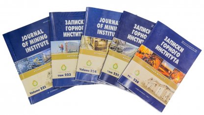
Записки Горного института
The paper discusses the results of interpreting well tracer studies. It is shown that from the law of mass conservation it follows that when filtering a volume of an indicator, part of the injected tracer flows into the matrix. With the flow of fluid containing the indicator from the low-filtration resistance channel (LFR) into the surrounding matrix, the linear dimensions of the flow area depend on the permeability and porosity properties of the high-permeability channel and the matrix. While another part of the tracer moves toward the production well, its mass is lost due to diffusion processes. From the solution of the diffusion equation, it follows that the initial concentration of the tracer decreases in the course of filtration along the LFR channel. To interpret the results of the tracer studies, different cases of the LFR channels’ location in the volume of the productive formation are considered. The varied parameter allows characterizing the presence of several peaks in the concentration of the indicator and calculation the filtration parameters of the LFR channels.
Записки Горного института
Актуальность работы обусловлена необходимостью повышения технико-экономических показателей строительства скважин на основе прогнозирования и предупреждения прихватов бурильного инструмента, обусловленных сужением открытого ствола скважин в интервалах трансверсально-изотропных горных пород. Разработана математическая модель упруговязкопластического перемещения стенок наклонно направленных и горизонтальных скважин при сужении открытого ствола скважин вследствие ползучести в интервалах трансверсально-изотропных горных пород.
Записки Горного института
During development of drilling projects, a whole array of data is needed considering the properties of rocks and the conditions of their bedding. Accounting for geomechanical processes occurring in the near-wellbore zone allows avoiding many complications associated with the violation of the wellbore walls stability at all stages of its construction and operation. Technological and technical factors such as vibration and rotation of the drilling string, formation of launders during the descent and ascent of the assembly, pressure pulsation during the start and stop of pumps, hydrostatic and hydrodynamic pressure of the drilling fluid, its composition and properties, have a great influence on the stress-strain state of the medium opened by the well. The washing fluid circulating in the well should provide backpressure to the reservoir, not interact with the rocks chemically, colmatage channels in porous and fractured rocks, preventing penetration of the mud into the medium, by creating an impermeable barrier at drilling clay seams that are prone to swelling, cracking, etc.

During the development of minerals by the underground method, dynamic manifestations of rock pressure occur at a certain depth, which significantly reduces the safety of mining operations. Regulatory documents prescribe at the exploration and design stages to establish the critical depth for classifying a deposit as liable to rock bumps. Currently, there are a number, mainly instrumental, methods for determining the liability of rock mass to rock bumps and methods based on the determination of physical and technical properties and the stress-strain state of rock massifs.
Показана роль геомеханики для прогнозирования развития геосистем и обеспечения безопасности эксплуатации горных предприятий в условиях перехода к новому технологическому укладу. Рассмотрено состояние и перспективы развития минерально-сырьевой базы, включая арктическую зону Российской Федерации.
Записки Горного института
The paper considers the cutting of brittle coals and rocks by a single cutter of a mining machine, in contrast to the generally accepted integral approach, different from the standpoint of the formation of successive elementary bursts that make up the cut. The process of the formation of an elementary bust in time is viewed as successive phases. Due to the complexity and multi-factor nature of the process, preference is given to experimental bench studies using reference cutters, isotropic materials, and real rock blocks.
иран
In the southern part of the Khur area, there is faults system with predominantly North-West strike. This network of tectonic disturbances is one of the most important fault systems in Central Iran which crosses Paleozoic metamorphic rocks, Cretaceous limestones, and Eocene volcanic rocks. Interpretation of satellite imagery ETM+(Enhanced Thematic Mapper plus, Landsat) and field observations showed the presence of left-lateral shifts along with fault system.
Записки Горного института
The work is devoted to the issues of seismic microzonation representativeness, which is amongst the mandatory assessments that precedes civil and industrial construction. In addition to the practical approach and in accordance with the normative documentation, the authors propose parametric interpretation of the remote basis by means of tracing geodynamic zones and elements of the geoblock structure, where the leading marker of seismogenic risk zones is the anomaly of spatial variability of the geofield, coinciding with the discordant intersection of localised land structures. Verification of this marker is achieved by displaying a cartographic distribution image within the range of the seismic point increment, detailed on the basis of approximation dependencies.